(Editor’s Note: This commentary is expanded from a blog post originally published on the NFPA Xchange on January 28, 2019.)
by Michele Steinberg
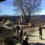
It was clear that the destroyed homes we saw were more flammable than the vegetation around them. On a tour of the devastation wrought by the Camp Fire in Butte County, my NFPA colleagues Ray Bizal and Tom Welle and I saw textbook cases of the impacts of embers, structure-to-structure ignition and wind-driven wildfire all through the communities of Paradise and Magalia.
We were part of a group invited by the Western Fire Chiefs Association, who coordinated a learning tour of the area along with CAL FIRE and the local fire chief on January 22. The goal was to include not only fire service professionals but also researchers, insurance industry representatives, and those involved in safety outreach and advocacy such as NFPA. We welcomed the rare opportunity to gain a first-hand local perspective on the event from CAL FIRE and local officials.
On the evening before the tour, we heard from CAL FIRE Deputy Chief of Wildland Fire Prevention Engineering Steven Hawks about his parents’ harrowing experience in evacuating Paradise, where Steven and his brother David were born and raised. Both escaped safely, though it took their mother three hours to reach her destination. On meeting Butte County Fire Chief and CAL FIRE unit chief David Hawks the next morning, he filled in more of the story, including the heartbreak of the loss of his parents’ home to the fire.
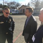
It’s important to note that this tour was not an attempt to seek out causes or lay blame but to understand more fully what had happened and the magnitude of the damage. Chief Hawks provided more details about the impact on the fire on the community, noting that Feather River Hospital, which lost the entire building housing its cardiology unit, is the area’s largest employer. In terms of challenges to evacuating people and fighting the fire, while cameras are in place to aid in fire detection, they were not in the area of fire origin. In terms of fuel reduction efforts, Hawks deemed forest thinning and other treatments as good but inadequate in terms of slowing the fire, likening the effort to “dipping water out of Lake Oroville with a five-gallon bucket”. Too little too late.
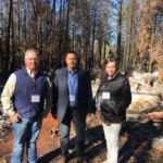
[confirm caption, shift to higher res photo if available – tour members]
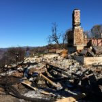
We observed that the wildfire was an equal opportunity destroyer, leveling high-end homes and more modest manufactured homes across the communities of Paradise and Magalia. According to the incident synopsis provided by the Western Fire Chiefs Association, one of the major considerations was, “Ember ignition, ember ignition, ember ignition. The Camp Fire was all about ember ignition. Paradise and surrounding area are in a Pine forest. The ground was littered with pine needles. Ponderosa Pines drop about 1/3 of their needles each year…even those who had ‘raked’ their yards had a new fuel bed due to the wind.” The synopsis also indicated that there were areas where urban conflagration took place – when one structure ignited, providing enough radiant heat and embers to ignite the next structure, and so on. During the tour, Chief Hawks said while no homes in Paradise had flammable wood roofing, the pine needle deposition on and around homes was the primary fuel bed for embers that finally ignited homes. He even described a home saved by firefighters who put out the smoldering pine needles in a gutter.
We received materials on the tour including wildfire preparedness brochures and guides developed by the Butte County Fire Safe Council, a long-active group that has promoted safety guidance including NFPA’s Firewise USA® program. While wildfire preparedness was embraced among many residents, the age, condition, and proximity of homes to brush, trees, and debris as well as to one another made home destruction in this intense, fast-moving, wind-driven wildfire inevitable.
Paradise officials and residents had planned and practiced evacuations, but according to the fire chief, they had never contemplated having to evacuate the entire town simultaneously. Chief Hawks was careful to tell us the specifics of the deaths of the 85 people who perished, with only one person dying on the main evacuation route after hitting a tree. He said most died in their homes, immediately outside their homes, or in their vehicles in areas far from the main road. This pattern speaks to the challenges of adequate warning time during a fast-moving fire, and to the fact that most of the people who died were elderly, disabled or both. Even if they heeded the warning, in many cases they were simply not physically able to escape.
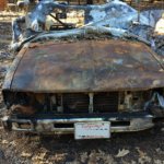
The fire’s destruction was typical in terms of unprepared homes that were more flammable than the vegetation surrounding them and often close enough to one another to cause an urban conflagration – both elements hallmarks of American wildland/urban interface fires. What stood out for me was the sheer size of the damage footprint. We drove miles and miles to encounter the same terrible story at every stop – unconsumed large trees and completely destroyed homes and vehicles.
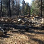
Enormous trees some six- to eight-feet in diameter lay along nearly every roadside, toppled post-fire by the utility company because they were on the main roadway and viewed as additional risks to the fragile power lines in the area. As our group got in and out of vehicles time and again, it was shocking to see the mass destruction against the backdrop of natural beauty in the forests, ridges, and mountains all around us. One insurance professional told me she hadn’t realized that firefighters wouldn’t have had anything close to an adequate water supply to help protect structures during such an extreme event.
The region has enormous challenges ahead in recovery. Even residents whose homes survived are still out of their homes due to benzene in the drinking water. Small business owners whose physical locations survived have few customers left in the area. The wholesale destruction of thousands of residences in a region where the housing market is already squeezed and contractors are in short supply predict a long and difficult road ahead. There are a number of positive efforts occurring locally to support those made homeless by the event and related recovery needs, and insurers are busy providing claims services to help people back on their feet financially. But everyone should understand the magnitude of the destruction and the huge challenges that the whole community faces for the future.
The Paradise Chamber of Commerce (http://www.paradisechamber.com/), the town mayor, Butte County Recovers https://buttecountyrecovers.org/paradise/ and more are coming together to try to encourage safer rebuilding and help connect volunteers and donations with people in need while trying to boost the business community by listing the status of open or reopening businesses. Sadly, some businesses will never reopen, while some are struggling and realizing they cannot survive. (See this link for background: http://www.paradisechamber.com/events/details/mendon-s-nursery-closing-sale-03-21-2019-12129].
An article from ABC 10 in Sacramento in early February documented the diaspora of evacuees using a map created by a family member of Camp Fire survivors. It is updated via a Facebook page as survivors enter the current addresses and shows nearly 300 people spread across 31 states. [https://www.abc10.com/article/news/local/paradise/map-shows-where-camp-fire-survivors-have-relocated-since-the-disaster/103-16fa6184-aacd-4a59-8d66-520f59941e4d]
Former FEMA Administrator Craig Fugate was recently quoted talking about our society’s failure to plan for the worst case scenario. A quick Google search shows that he’s been talking about this for at least a decade, imploring not only emergency managers and government agencies to start a shift in thinking, but also calling on residents to recognize and acknowledge that government alone cannot avert the destruction and suffering from the next flood, hurricane or wildfire to come along. If nothing else, I hope the Camp Fire is the motivation for communities all over the country facing natural hazard risks to engage, plan and act to address the situation long before the next deadly event occurs.
Photos taken by Michele Steinberg, NFPA, in Magalia, California, January 22, 2019.
ABOUT THE AUTHOR: Michele Steinberg manages the Wildfire Division of the National Fire Protection Association and is a board member of IAWF.
